


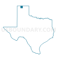
Voting District 0101, Sherman County, Texas
About
Outline

Summary
| Unique Area Identifier | 676724 |
| Name | Voting District 0101 |
| County | Sherman County |
| State | Texas |
| Area (square miles) | 212.13 |
| Land Area (square miles) | 212.03 |
| Water Area (square miles) | 0.10 |
| % of Land Area | 99.95 |
| % of Water Area | 0.05 |
| Latitude of the Internal Point | 36.16891170 |
| Longtitude of the Internal Point | -102.04551590 |
Maps


Graphs
Select a template below for downloading or customizing gragh for Voting District 0101, Sherman County, Texas


Neighbors
Neighoring Voting District (by Name) Neighboring Voting District on the Map
- Voting District 0002, Dallam County, TX
- Voting District 0005, Dallam County, TX
- Voting District 0101, Hartley County, TX
- Voting District 0101, Moore County, TX
- Voting District 0102, Sherman County, TX
- Voting District 0201, Sherman County, TX
- Voting District 0202, Sherman County, TX
- Voting District 0401, Sherman County, TX
- Voting District 0401, Moore County, TX
- Voting District 0402, Moore County, TX
Top 10 Neighboring County Subdivision (by Population) Neighboring County Subdivision on the Map
- Dumas CCD, Moore County, TX (19,812)
- Dalhart CCD, Dallam County, TX (5,936)
- Stratford CCD, Sherman County, TX (2,267)
- Sunray CCD, Moore County, TX (2,092)
- Channing CCD, Hartley County, TX (1,013)
- Texhoma CCD, Sherman County, TX (767)
Top 10 Neighboring Place (by Population) Neighboring Place on the Map
Top 10 Neighboring Unified School District (by Population) Neighboring Unified School District on the Map
- Dumas Independent School District, TX (19,719)
- Stratford Independent School District, TX (2,483)
- Sunray Independent School District, TX (2,128)
- Hartley Independent School District, TX (886)
Top 10 Neighboring State Legislative District Lower Chamber (by Population) Neighboring State Legislative District Lower Chamber on the Map
Top 10 Neighboring State Legislative District Upper Chamber (by Population) Neighboring State Legislative District Upper Chamber on the Map
Top 10 Neighboring 111th Congressional District (by Population) Neighboring 111th Congressional District on the Map
Top 10 Neighboring Census Tract (by Population) Neighboring Census Tract on the Map
- Census Tract 9502, Moore County, TX (6,671)
- Census Tract 9502, Hartley County, TX (6,062)
- Census Tract 9502, Sherman County, TX (3,034)
- Census Tract 9501, Moore County, TX (2,092)
- Census Tract 9501, Dallam County, TX (1,455)